A joint service of the UK Ag Weather Center and the National Weather Service.
National Weather Service Indianapolis IN
1001 AM EDT Fri Mar 14 2025

.KEY MESSAGES...

- Threat for fast moving severe thunderstorms with damaging winds,
  large hail and a few tornadoes tonight into early Saturday

- Strong gradient winds likely this afternoon through Saturday
  with frequent gusts to 40 MPH this afternoon, 45 to 55 MPH
  tonight, and 40 to 50 MPH Saturday

- Enhanced Fire Risk this afternoon

- Rainfall totals of 1 to 2 inches with locally higher amounts
  tonight through Saturday night may produce localized flash flooding
  and lowland river flooding
 NWS Weather Discussion
National Ag. Weather Outlook (Repair this link), International Highlights ,International Ag. Weather Summary
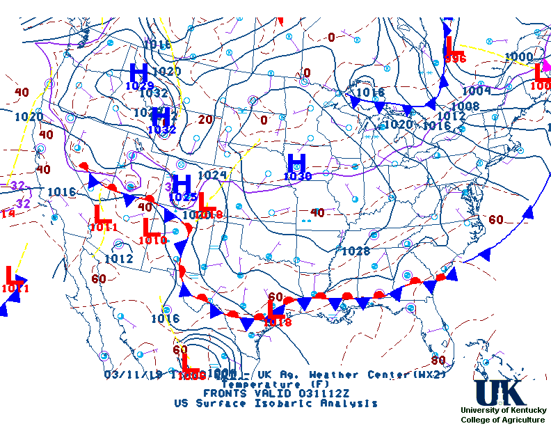
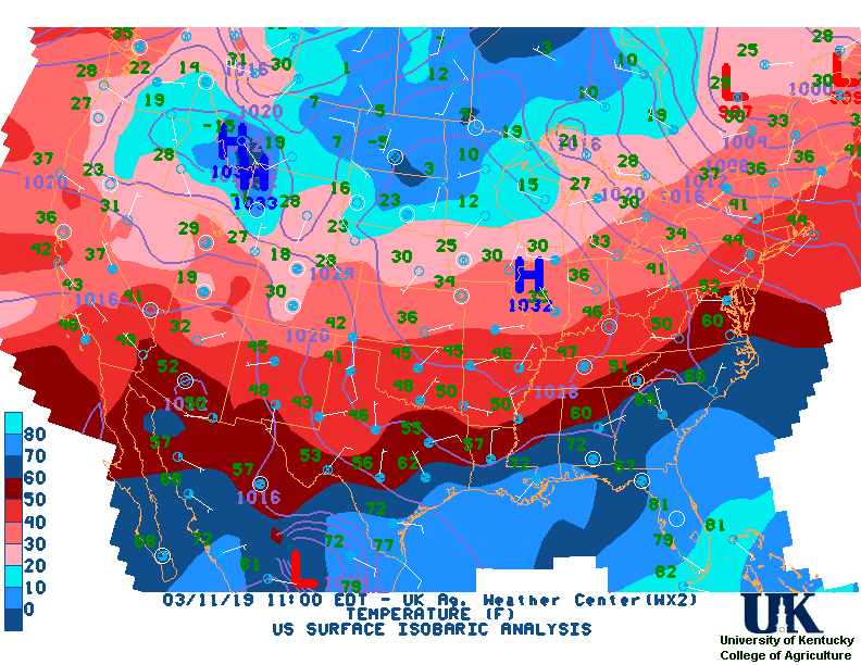
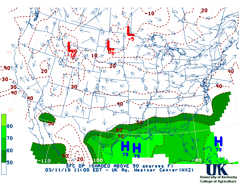
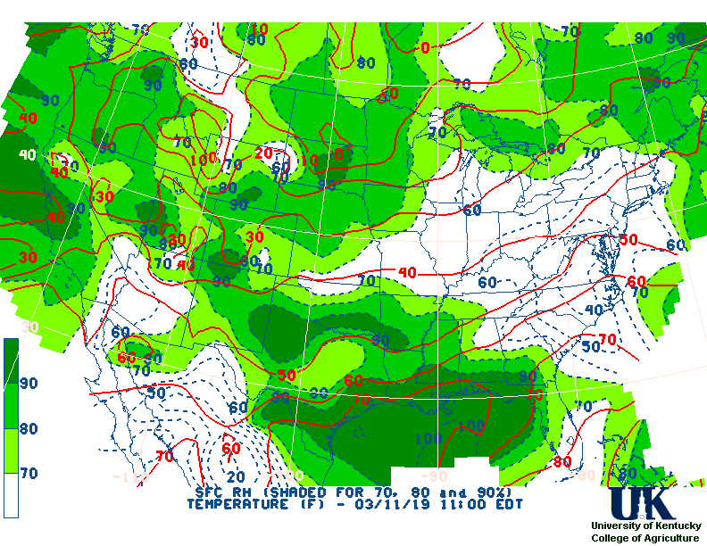
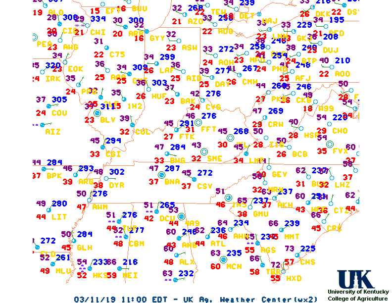
Current Surface Map,
[2nd Source TWC]
Click here for UKAWC Point Agricultural, Lawn & Garden Forecast/Outlook in case of corrupt tables.
Regional Hourly Observations For County
Issued at 1000 AM EDT FRI MAR 14 2025
NORTHWEST INDIANA

CITY           SKY/WX    TMP DP  RH WIND       PRES   REMARKS
GARY /AIRPORT/ SUNNY     55  46  71 S8        29.71F
KNOX *+        MOSUNNY   54  36  50 S10       29.76S
LA PORTE +     MOSUNNY   54  45  71 SE10      29.76S
MICHIGAN CITY+ MOSUNNY   52  41  66 SE7       29.75F
MONTICELLO +   MOSUNNY   55  46  71 CALM      29.77S
RENSSELAER +   PTSUNNY   55  46  71 SE7       29.75F
VALPARAISO     MOSUNNY   52  42  69 SE8       29.75F
Hourly Obs.,
Current Temperatures,
Dewpoint,
Rh,
Wind,
Regional Obs.,
Station Model,
Surface 4-Panel
Meteograms:
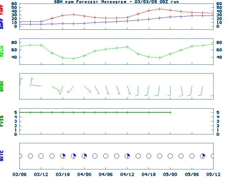
South Bend ,
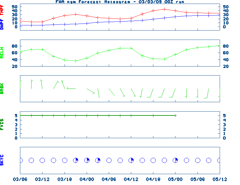
Fort Wayne ,
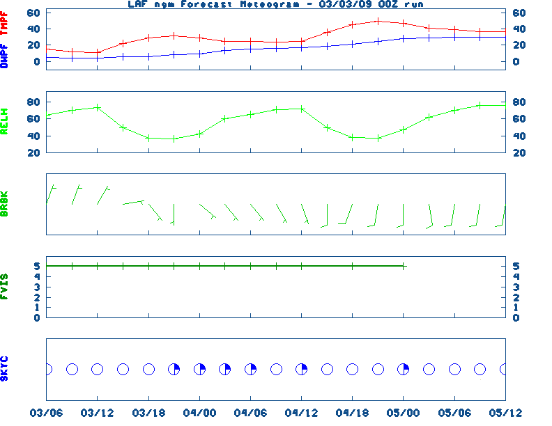
Lafayette ,
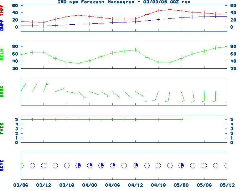
Indianapolis ,
Evansville
Current Agricultural Weather Conditions in Indiana
Based on observations at 1000am EDT, Friday March 14, 2025
Across Indiana...temperatures are near 53 degrees north, near 59 degrees central, and near 61 degrees south. Current sky conditions are mostly sunny north, partly sunny central, and mostly sunny south. In the north, relative humidity is near 54%, and the dew point is near 37 degrees. In the central part of the state, relative humidity is near 67%, and the dew point is near 48 degrees. In the south, relative humidity is near 70%, and the dew point is near 51 degrees. Winds are from the southeast at 12 mph north, where conditions are favorable for spraying. Winds are from the southeast at 13 mph central, where conditions are not favorable for spraying due to strong winds. Winds are from the southeast at 8 mph south, where conditions are favorable for spraying. Based on current available observations, the highest temperature is 63 degrees at Shelbyville. The lowest temperature is MOSUNNY degrees at and Warsaw.
Current NOWCAST not available:
Nowcasts are not issued routinely during fair weather. Only when
precipitation or other significant weather is occuring in this county will these
forecasts be issued. Currently, there is no short term forecast in effect.
U.S. Radar,
All NWS Radars (In near-real time),
LSI Heat Index,
Wind Chill Map
Hazardous Weather Outlook For County,IN
427 AM CDT Fri Mar 14 2025 /527 AM EDT Fri Mar 14 2025/

 DAY ONE  Today and Tonight.

Weather hazards expected
Significant Fire Weather Risk this afternoon.
Elevated Non Thunderstorm Wind Risk this afternoon.
Elevated Thunderstorm Risk tonight...with an associated:
Level 4 of 5 Damaging Wind Risk...up to 70 mph.
Level 2 of 5 Tornado Risk.
Level 2 of 5 Large Hail Risk...up to one inch in diameter.
DISCUSSION
Winds out of the south will gust as high as 45 to 50 mph this
afternoon and evening. The strong winds in conjunction with dry
fuels and low relative humidities will lead to a significant
threat for the spread of brush fires today.
Additionally, a line of strong to severe thunderstorms is expected
to move across northern Illinois and northwestern Indiana this
evening into tonight. Damaging straight-line winds are the biggest
concern, although severe hail and even a few tornadoes are also
possible.
DAYS TWO THROUGH SEVEN Saturday through Thursday.
Saturday
Significant Non Thunderstorm Wind Risk.
Elevated Fire Weather Risk.
Wednesday and Thursday
Limited Snow Risk.
DISCUSSION
Strong to potentially damaging southwesterly winds are expected
Saturday morning and afternoon with gusts upwards of 60 mph. The
strong winds may also lead to an elevated risk for fire spread on
Saturday.
SPOTTER INFORMATION STATEMENT
Spotters will likely be needed this evening.
GENERAL STORM MOTION OF THE DAY:
Moving toward the east at 40 to 45 mph.
NWS Severe Weather Map , Convective Outlook
7-Day Forecast For County, IN
Issued at
338 AM CDT Fri Mar 14 2025
WIND ADVISORY REMAINS IN EFFECT FROM 4 PM FRIDAY TO 4 AM CDT
SATURDAY
HIGH WIND WATCH REMAINS IN EFFECT FROM SATURDAY MORNING
THROUGH SATURDAY AFTERNOON
TODAY
Partly cloudy through mid morning, then becoming mostly
sunny. Windy. Highs in the upper 70s. Unseasonably warm.
Southeast winds 10 to 15 mph with gusts up to 30 mph through mid
morning, increasing to south 15 to 25 mph with gusts up to 40 mph
in the afternoon.
TONIGHT
Showers with thunderstorms likely. Windy with lows in
the mid 50s. Unseasonably warm. South winds 15 to 25 mph early in
the evening, increasing to 20 to 30 mph in the late evening and
early morning, then diminishing to 10 to 20 mph late. Gusts up to
45 mph. Chance of precipitation near 100 percent.
SATURDAY
Partly cloudy with a slight chance of showers. A
slight chance of thunderstorms in the afternoon. Windy with highs
in the upper 60s. South winds 20 to 30 mph through mid morning,
increasing to southwest 25 to 35 mph in the late morning and
early afternoon, then diminishing to 15 to 25 mph late in the
afternoon. Gusts up to 55 mph. Chance of precipitation
20 percent.
SATURDAY NIGHT
Mostly cloudy. A slight chance of showers in
the evening, then a chance of showers after midnight. Lows in the
mid 30s. Southwest winds 10 to 15 mph with gusts up to 25 mph in
the evening, becoming west after midnight. Chance of
precipitation 30 percent.
SUNDAY
Mostly cloudy. A chance of snow and rain showers in the
morning. Highs in the lower 40s. West winds 10 to 15 mph in the
morning, becoming 10 to 20 mph in the afternoon. Chance of
precipitation 30 percent.
SUNDAY NIGHT
Partly cloudy. Lows in the lower 30s.
MONDAY
Partly cloudy in the morning, then becoming mostly
sunny. Highs in the lower 60s.
MONDAY NIGHT
Mostly clear. Lows in the mid 40s.
TUESDAY
Partly cloudy in the morning, then becoming mostly
cloudy. Breezy with highs in the lower 70s.
TUESDAY NIGHT
Mostly cloudy. Lows in the mid 50s.
WEDNESDAY
Mostly cloudy with a 50 percent chance of rain.
Breezy with highs in the upper 60s. Temperature falling into the
upper 50s in the afternoon.
WEDNESDAY NIGHT
Rain in the evening, then rain and snow likely
after midnight. Breezy with lows in the lower 30s. Chance of
precipitation 80 percent.
THURSDAY
Mostly cloudy in the morning, then becoming partly
cloudy. A chance of rain and snow. Highs in the lower 40s. Chance
of precipitation 50 percent.
12-48 Hr ETA Surface,
12-48 Hr ETA 500mb/Sfc,
24 Hr. Comparsion,
TWC Forecast,
Fire Danger,
Day 1 Precip,
Day 2 Precip,
Days 1-5 Precip
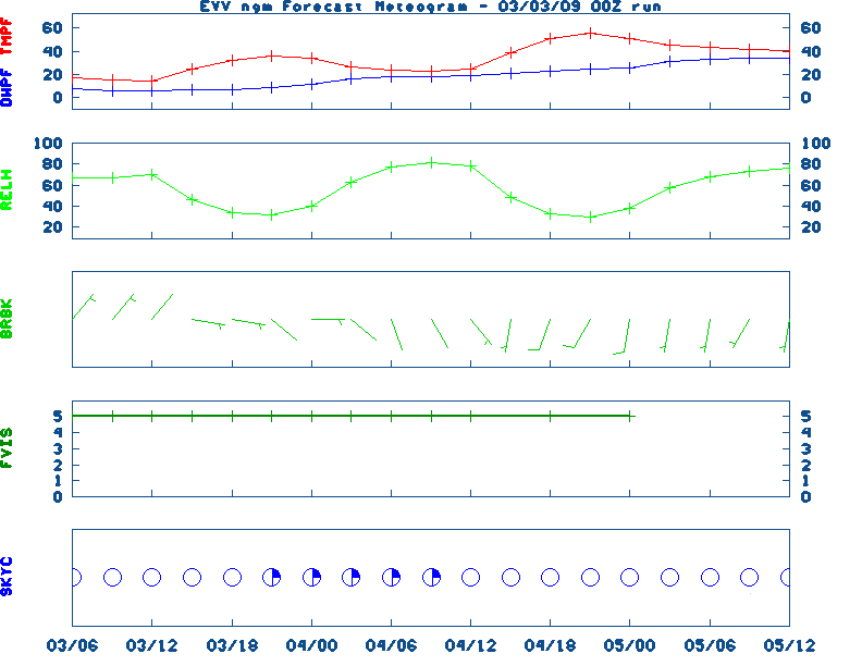
NGM 60 Hr Forecast Meteograms:
South Bend ,
Fort Wayne ,
Lafayette ,
Indianapolis ,
Evansville ,
Severe Weather Pot.-Day 1,
Day 2
Medium & Long Range Outlook For Indiana
                              INDIANA
                 ---------------------------------------------
                 6 TO 10 DAY  8 TO 14 DAY   30 DAY    90 DAY
                   MAR 19-23    MAR 21-27    JUN       JUN-AUG
                 -----------  -----------  --------  ---------
   Temperature:      Above        Above
 Precipitation:      Above        Above

....  Medium and long range outlooks provided by NCEP/K. Thomas Priddy
5 Day Rainfall Total Forecast,
6 to 10 Day ,
8 to 14 Day ,
Text,
30-Day Outook,
90-Day,
120-Day
Almanac Information
Yesterday's Highs ,
Lows
Sunrise/Sunset/Moonrise/Moonset Computation (USN)
Historical Weather And Climate Facts For Today
MARCH 14TH
HISTORIC WEATHER EVENTS
...1870...
The term "blizzard" was first applied to a storm which produced heavy snow
and high winds in Minnesota and Iowa. (David Ludlum)
...1944...
A single storm brought a record 21.6 inches of snow to Salt Lake City UT.
(The Weather Channel)
...1960...
Northern Georgia was between snowstorms. Gainesville GA received 17 inches
of snow during the month, and reported at least a trace of snow on the
ground 22 days in March. Snow was on roofs in Hartwell GA from the 2nd to
the 29th. (The Weather Channel)

Ag Weather Center, Department of Biosystems & Agricultural Engineering, University of Kentucky
|


![[2nd Source TWC]](http://maps.weather.com/images/maps/current/curwx_720x486.jpg)