A joint service of the UK Ag Weather Center and the National Weather Service.
National Weather Service Nashville TN
649 PM CDT Wed Mar 12 2025

...New UPDATE...

.KEY MESSAGES...
Updated at 645 PM CDT Wed Mar 12 2025

- Scattered showers and thunderstorms (30 to 60 percent chance)
  late Wednesday night and Thursday. No severe weather
  anticipated.

- Severe thunderstorms possible Friday night through early
  Saturday morning, as well as Saturday afternoon and evening.
  Storms will pose a threat for damaging winds, large hail, and
  tornadoes.

- Gusty non-thunderstorm winds will accompany unsettled weather,
  Friday and Saturday. Low confidence in flooding Saturday
  afternoon and evening.
 National Ag. Weather Outlook, International Ag. Weather Summary National Ag. Weather Outlook, International Ag. Weather Summary
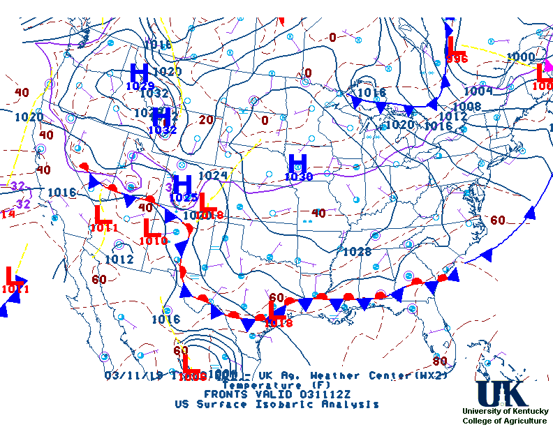
Current Surface Map,
[2nd Source TWC]
Click here for UKAWC Point Agricultural, Lawn & Garden Forecast/Outlook in case of corrupt tables.
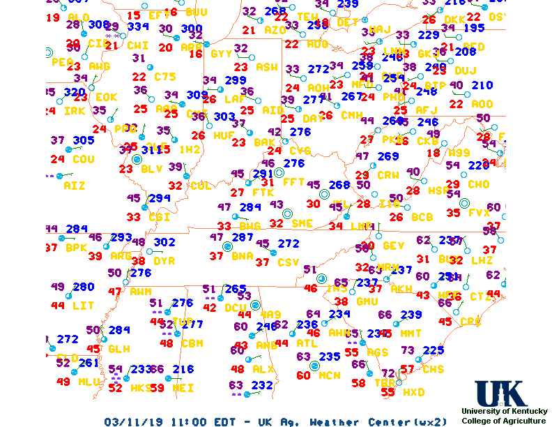
Regional Hourly Observations For County
Current Temperatures,
Dewpoint,
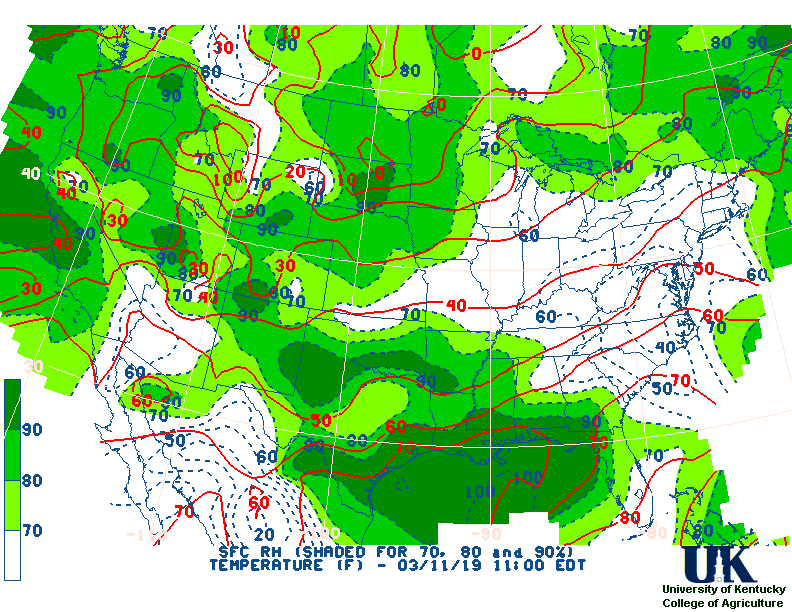
RH,
Wind,
Regional Obs,
Surface 4-Panel
Current Agricultural Weather Conditions in Tennessee
Based on observations at 1000pm CDT, Wednesday March 12, 2025
Across Tennessee...temperatures are near 68 degrees west and near 63 degrees central. Current sky conditions are cloudy west and mostly cloudy central. In the west, relative humidity is near 54%, and the dew point is near 51 degrees. In the central part of the state, relative humidity is near 38%, and the dew point is near 37 degrees. Winds are from the south at 7 mph west, where conditions are favorable for spraying. Winds are from the south at 7 mph central, where conditions are favorable for spraying. Winds are unavailable east. Based on current available observations, the highest temperature is 68 degrees at Memphis International Airport. The lowest temperature is 63 degrees at Nashville.
Current NOWCAST not available:
Nowcasts are not issued routinely during fair weather. Only when
precipitation or other significant weather is occuring in this county will these
forecasts be issued. Currently, there is no short term forecast in effect.
US Radar,
All NWS Radars (In near-real time),
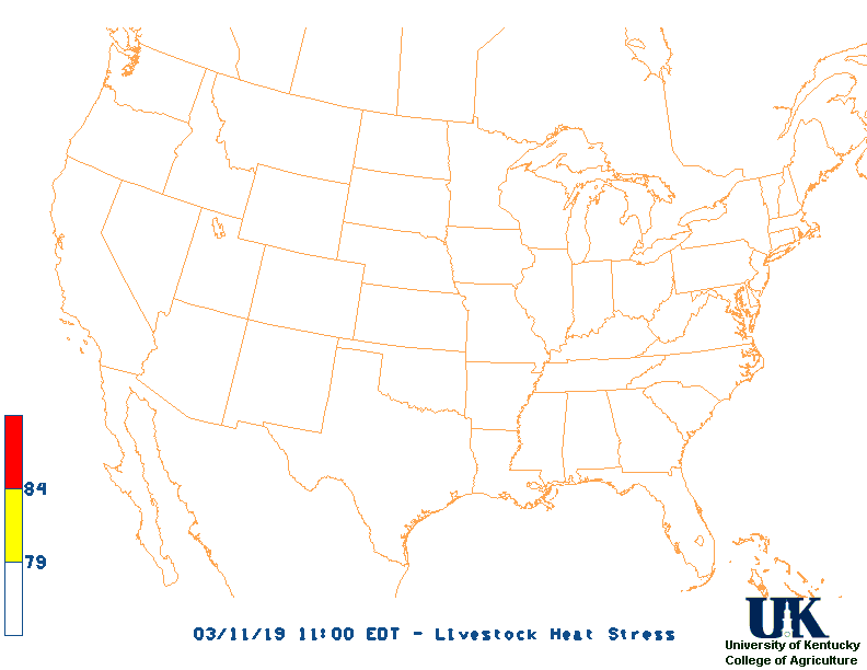
Current Livestock Heat Stress Index (LSI),
Current Wind Chill Map
Hazardous Weather Outlook For County
Hazardous report currently not available
NWS Severe Weather Map , Convective Outlook
7-Day Forecast For County, TN
433 PM CDT Wed Mar 12 2025
TONIGHT
Mostly cloudy. Showers likely with a chance of
thunderstorms after midnight. Lows in the upper 50s. South winds
5 to 10 mph. Chance of rain 60 percent.
THURSDAY
Partly sunny with a chance of showers and
thunderstorms in the morning, then sunny in the afternoon. Highs
in the mid 70s. South winds 5 to 10 mph. Chance of rain
50 percent.
THURSDAY NIGHT
Mostly clear in the evening, then becoming
partly cloudy. Lows in the upper 50s. Southeast winds 5 to
10 mph.
FRIDAY
Mostly sunny. A slight chance of showers and
thunderstorms in the afternoon. Windy with highs in the upper
70s. South winds 15 to 25 mph with gusts up to 35 mph. Chance of
rain 20 percent.
FRIDAY NIGHT
Mostly cloudy with showers with a chance of
thunderstorms in the evening, then partly cloudy with a chance of
showers after midnight. Windy with lows around 60. South winds
15 to 25 mph with gusts up to 35 mph. Chance of rain 90 percent.
SATURDAY
Partly sunny. A slight chance of showers and
thunderstorms in the morning, then a chance of showers in the
afternoon. Breezy with highs in the lower 70s. Temperature
falling into the mid 60s in the afternoon. Chance of rain
40 percent.
SATURDAY NIGHT
Partly cloudy. A chance of showers with a
slight chance of thunderstorms in the evening. Much cooler with
lows in the mid 40s. Chance of rain 30 percent.
SUNDAY
Mostly sunny. Much cooler with highs in the mid 50s.
SUNDAY NIGHT
Mostly clear. Lows in the upper 30s.
MONDAY
Sunny. Highs in the mid 60s.
MONDAY NIGHT
Mostly clear in the evening, then becoming partly
cloudy. Not as cool with lows around 50.
TUESDAY
Mostly sunny and breezy. Highs in the lower 70s.
TUESDAY NIGHT
Mostly cloudy and breezy. Lows in the lower 50s.
WEDNESDAY
Mostly cloudy with a slight chance of showers and
thunderstorms in the morning, then partly sunny with a chance of
showers in the afternoon. Breezy with highs in the upper 60s.
Chance of rain 40 percent.
12-48 Hr Surface Forecast Maps,
TWC 4-Panel Surface Forecast,
Fire Danger,
Day 1 Precip,
Day 2 Precip,
Days 1-5 Precip,
Severe Weather Pot.-Day 1,
Day 2
Medium & Long Range Outlook For Tennessee
                            TENNESSEE
                 ---------------------------------------------
                 6 TO 10 DAY  8 TO 14 DAY   30 DAY    90 DAY
                   MAR 18-22    MAR 20-26    JUN       JUN-AUG
                 -----------  -----------  --------  ---------
   Temperature:      Above        Above
 Precipitation:      Above        Above

....  Medium and long range outlooks provided by NCEP/K. Thomas Priddy
5 Day Rainfall Forecast,
6 to 10 Day ,
8 to 14 Day ,
Text,
30-Day Outook,
90-Day Outook,
120-Day Outlook
Almanac Information
Historical Weather And Climate Facts For Today
MARCH 12TH
HISTORIC WEATHER EVENTS

...1888...
One of the most vicious blizzards ever to strike the U.S. was in progress across
Northeast.  When the storm finally ended on the 13th, Saratoga, New York was
buried under 58 inches of new snow and 50 inches was recorded at Middletown,
Connecticut. Winds to hurricane force whipped drifts over 30 feet deep.  The
combination of snow, wind, and record cold temperatures claimed 400 lives.  New
York City received 20.7 inches of snow and Albany, New York had 46.7 inches.

...1923...
The record low pressure of 28.70 inches for Chicago, Illinois was set during a
winter storm.  Heavy snow, a thick glaze, gales, and much rain caused $800,000
damage.

...1954...
A blizzard raged from eastern Wyoming into the Black Hills of western South
Dakota while a severe ice storm was in progress from northeastern Nebraska to
central Iowa.  The ice storm isolated 153 towns in Iowa.  Dust from the Great
Plains caused brown snow, while hail and muddy rain fell over parts of
Wisconsin and Michigan.

...1967...
A tremendous four day storm was in progress across California. Winds to 90 mph
closed mountain passes, heavy rains flooded the lowlands, and in 60 hours
Squaw Valley was buried under 96 inches of snow.

...1990...
Unseasonably warm temperatures occurred from the Mississippi Valley to the
Atlantic coast.  Over 90 high temperature records for this date were broken or
tied.  Many of the records were topped by 15 degrees or more and some of the
records broken had been set 100 years ago or more.  The high temperature for the
nation was recorded in Baltimore, Maryland where the temperature reach 95
degrees.  Washington, DC and Richmond, Virginia both recorded 89 degrees.

...1993...
What was to become the "Great Blizzard of '93" began to develop as a huge
mesoscale convective complex formed in the western Gulf of Mexico.  As the low
pressure area moved eastward and intensified, howling north winds exceeding
hurricane force intensified behind the storm, were reported by platforms in the
Gulf.  One platform near 28.5N/92.5W recorded sustained winds of 85 mph with
gusts to 99 mph.  As the low crossed the coast around midnight near Panama City,
Florida, the central pressure was already down to 980 millibars (28.94 inches).
During the late evening into the early morning hours of the 13th, a vicious
squall line swept through Florida and spawned 11 tornadoes resulting in 5
fatalities.  Thunderstorm winds gusted to 110 mph at Alligator Point and 109 mph
at Dry Tortugas.  Extremely high tides occurred along the western Florida coast.
A 13 foot storm surge occurred in Taylor County, Florida, resulting in 10 deaths
with 57 residences destroyed.  A 5 to 8 foot storm surge moved ashore in Dixie
County.  Over 500 homes were destroyed with major damage to another 700
structures.

Ag Weather Center, Department of Biosystems & Agricultural Engineering, University of Kentucky
|


![[2nd Source TWC]](http://maps.weather.com/images/maps/current/curwx_720x486.jpg)